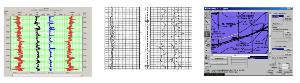
Well Log & Map Digitization
Bulwark Services Limited has the technical expertise and innovative tools required in the digitization of all kinds of wireline formation evaluation logs (such as GR, resistivity, sonic, density, neutron, spectral GR, and SP logs e.t.c.), dip meter logs (such HDT and tadpoles) and interpreted lithology logs.
We have executed a number of map digitization projects for the Nigerian E & P majors. The work involved digitization of contours, faults, horizons, well locations and shot points on structural geological maps, digitization of different layers of facies from seismic facies maps, digitization of X-Y or navigation data from base maps and digitization of topographic, base and coverage maps.
Features Include:
- Automatic curve tracking algorithm, with a manual digitising option when required
- Accepts digital data in LIS, LAS, BIT or PTF format
- Ability to overlay digital data against scanned images to show the correlation between digital data and paper log, and to highlight discrepancies and missing data
- Resampling and units conversion capability
- Outputs digitised data to disk in LIS or LAS format